Virgin River Uranium
OVERVIEW
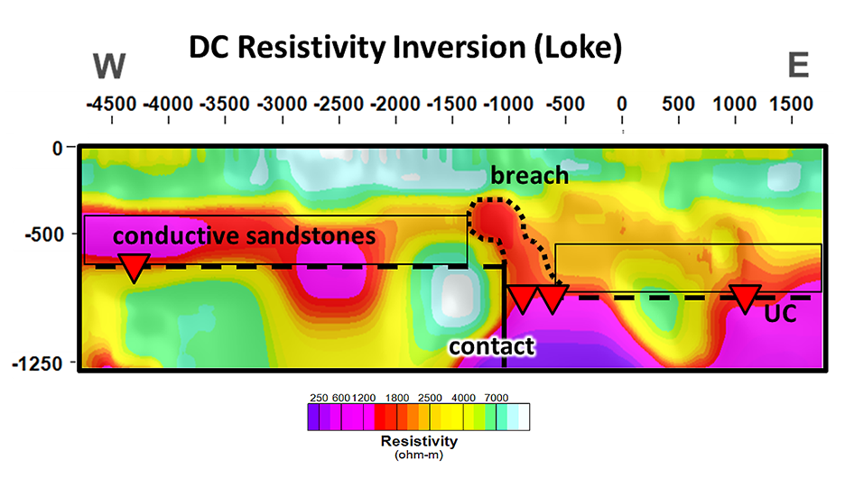
Dias Geophysical successfully imaged the geological structure, lithology and alteration related to a known mineralized structure at a depth of 700 m to 900 m. The survey identifies an alteration plume emanating up from a mineralized basement fault structure.
-
High-grade, unconformity-related Uranium
- Imaged alteration plume related to uranium mineralization
- Imaged basement lithologies below 900 m depth
SITUATION
Canada’s Athabasca Basin hosts the vast majority of high-grade uranium deposits. The Virgin River Uranium project occurs along a major structural corridor which hosts several world-class uranium deposits. The 2D survey line was completed to demonstrate the depth capabilities of the DIAS32 system in the Athabasca Basin environment. While direct detection of uranium deposits is not possible with geophysical methods, it is possible to image associated features such as the conductive graphite common in the host structures and the alteration plume that often emanates upward into the overlying sandstones.
DIAS32 SOLUTION
A 12.5 km 2D line was surveyed with the DIAS32 system across the Virgin River structure. The A
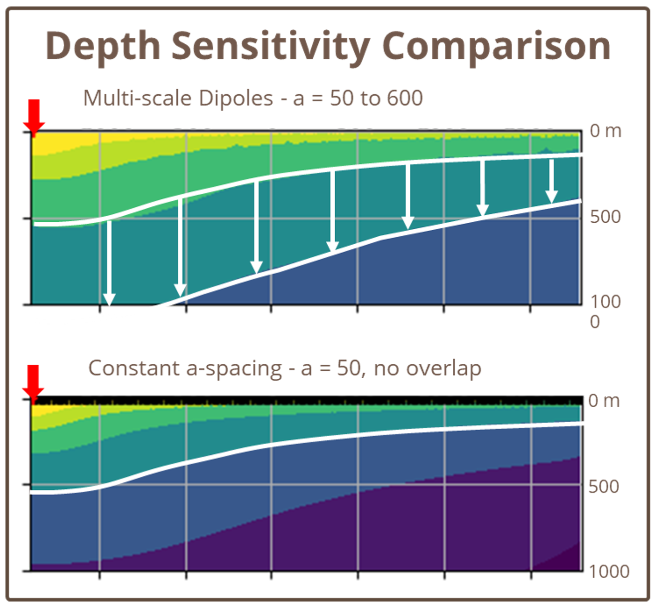
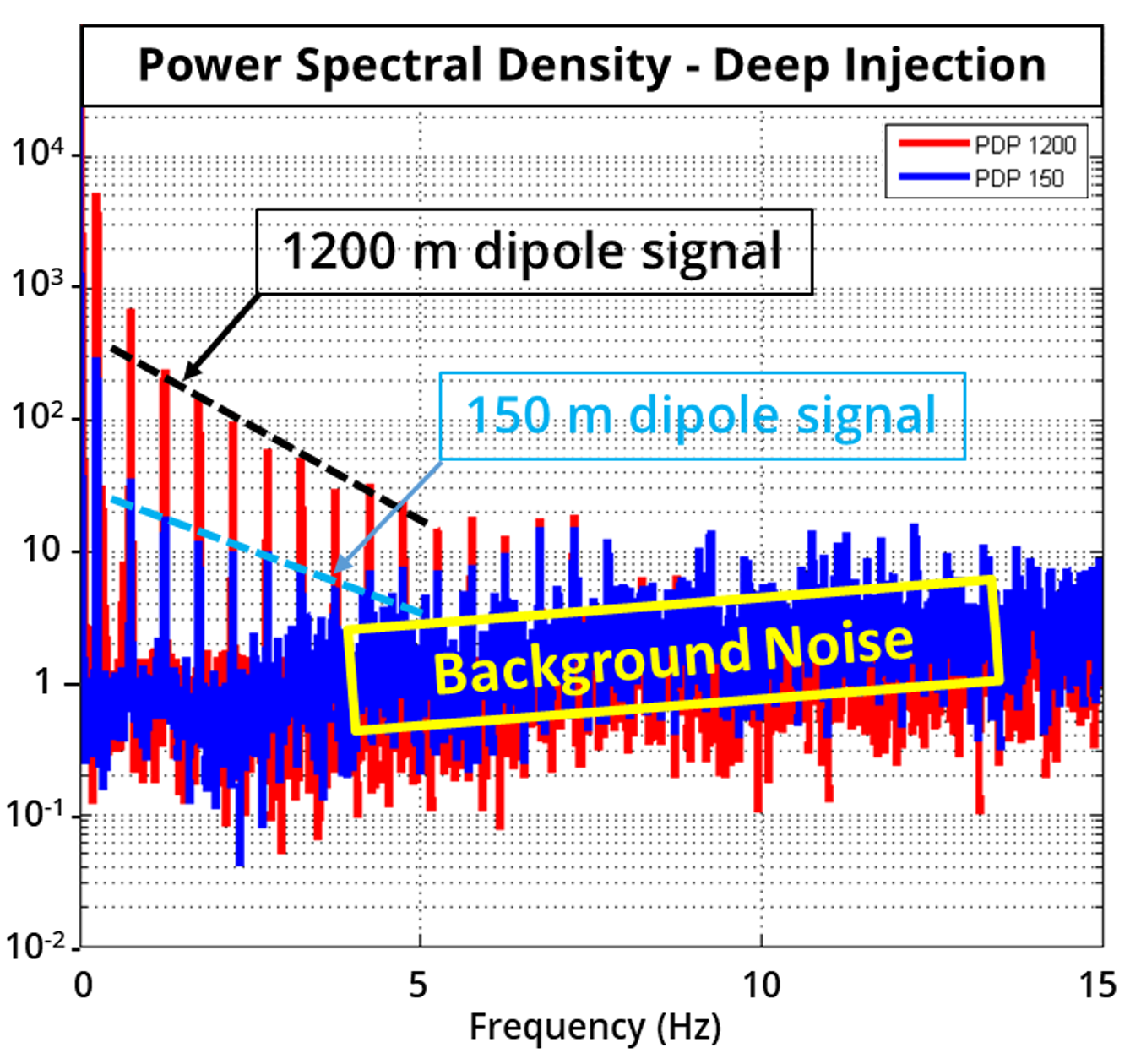
receiver spacing of 150 m and a current injection spacing of 75 m produced a relatively high data volume of 2D data with a- spacings of 150 m, 300 m, 450 m, etc. up to 1,200 m. This multi-scale data set was processed and inverted with the UBC-GIF and Loke RES3DINV codes to generate
high- resolution 2D resistivity sections from surface to a depth of 1.2 km.
OUTCOME
The DIAS32 2D test survey successfully imaged the alteration related to potential uranium mineralization in an area of the Athabasca basin where the unconformity lies at a depth of 700 m to 900 m. The survey mapped variation in the bedrock beneath the unconformity and hosted unconformity-related uranium deposits.


